 |
Home | Search | Browse | About IPO | Staff | Links |
|
Home | Search | Browse | About IPO | Staff | Links |
|
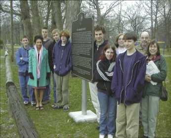
High-tech history By William Furry
The class, taught by SHS instructors John Taylor and Jenni Dahl, involves Geographical Information Systems (GIS) technology. Students use hand-held, satellite locators (Global Positioning System— GPS—readers) to pinpoint precise locations of local landmarks, then plot them on maps, which they design with special software. The students came to the Society's attention through a web site they created about the historic village of New Salem. The class had visited the site, plotted the coordinates of each cabin on a map, taken digital photographs of each, and written informational text to accompany them. Students did much ol the work alter school hours and, best of all, they weren't studying local history, per se. That part of the learning objective was icing on the curriculum cake.
The GIS class is currently working with the Illinois State Historical Society to create a web site that will map all of the ISHS historical markers in Illinois, county by county—more than 400 altogether. The site would include photographs (both aerial and specific), exact satellite locations from other GPS users, and informational text about the historical marker. SHS junior David Mann is building the web site, which can be found on the High schools homepage at http://www.shs.springfield.kl2.il.us/academics/departments/gis/markers/ illinois.html He and his classmates have visited every ISHS marker in Sangamon County. Last month David and his classmates presented their work at a GIS conference in Bloomington, an event organized by the Center for Governmental Studies at Northern Illinois University. When Jenni Dahl told conference coordinator Sherrie Taylor about the work her students were doing with the Illinois State Historical Society and the content of their presentations, Taylor was ecstatic: "Wow! I'm impressed, and boy, I wish there were more teachers like you around who are not afraid to take students into the real world and have a 'real' experience,' Taylor wrote. "That is just fantastic... those students will remember this for the rest of their lives, especially if they wind up with a career in geography! Getting teachers to gush about their students' work is easy; getting students excited about school is more difficult. But SHS student Tom Gossett didn't need any prodding. 6 | Illinois Heritage 'The GIS program at Springfield High School is superfantastic. We work out of the Mapping Our World textbook in conjunction with Arc View software. Recently we have been working with the assistant director of the Illinois State Historical Society. During the project we have learned immensely about the heritage of our community as well as gotten a chance to use our GIS knowledge and resources." Sixteen year-old Ryne Tate, an SHS baseball player, used GIS technology to map every baseball field he ever played on—all 118 of them— and plot them on an aerial map of Sangamon County. "The technology the class taught me is utterly amazing," Ryne observed. Other students in the class used their computer skills to identify and locate hate groups in Illinois; to analyze election results in Sangamon County; and to crunch state, local, and national census data by ethnic and social groups. One student's project looked at radiation fallout from atomic testing in the 1950s, and how it spread across the country. His research, data, and analysis belied his years, and caught the attention of several professional consultants at the conference. The GIS class was conceptualized by SHS social studies teacher Ann Schickner, who wrote the successful grant application to purchase the necessary equipment and software. Last year the class was offered as a pilot course. When course objectives firmly were established, history teacher and department chair John Taylor took the class proposal to the curriculum committee, which unanimously supported it as a social studies elective. For Jenni Dahl, the real challenge of the class is to keep ahead of her students, all of whom are self-motivated and creative. "These kids are pretty amazing and getting them to think is never a problem," says Dahl. Finding new and exciting ways to use the technology, such as the ISHS historical marker web site project, gets her students to think outside the classroom, she says. Through the web site, Dahl and her students hope to encourage other GIS students around the state to help identify and map ISHS markers. "This spring we gathered the necessary information for Sangamon County and in the process increased our knowledge of local history," Dahl noted in recruitment flyer at the Bloomington GIS conference. "Student groups in other counties could also benefit by participating in this project. All that is required to help is a GPS receiver and a digital camera. The global coordinates of the site and digital image (as an attachment) may be sent to: gis@springficld.kl2.il.us. In the body of the e-mail message please include the name of the marker. We would also like to give credit to all those who help with this project, so please let us know your name and affiliation (name of school, business etc.). We will keep an up-to-date list of the historical markers that are needed to complete the project on the web site and will link them to the map as they are received." Illinois Heritage|7 |
|
|