 |
Home | Search | Browse | About IPO | Staff | Links |
|
Home | Search | Browse | About IPO | Staff | Links |
|
William D.Walters Jr One of the more interesting questions raised by the Lewis and Clark expedition is the extent to which the route they followed to the Pacific influenced later development. This is not as simple a question as it may at first seem. The ideas that follow attempt to look at Lewis and Clark's route from the standpoint of its lasting influence on American locational patterns. By any standards Lewis and Clark's achievement was a remarkable one. We are in awe of the saga of brave men fighting wild animals, trudging through thick snow, subsisting on "horse beef" and dog meat, and carving a path through unknown wilderness. Yet we also must wonder about the lasting impact of the expedition. Upon reflection, one must realize that there is no necessary link between the amount of courage displayed by brave men and the extent to which these men influenced future patterns of cities. There is no doubt about the example of
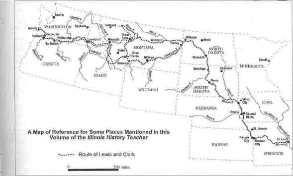
39 endurance and courage set by these explorers. Nor would many question the scientific importance of some of their findings. Still, neither of these things necessarily means that the direction they followed altered the paths that would eventually be taken by roads and railroads or the eventual location of yet-to-be-founded cities. Yes, Lewis and Clark did find a practical route to the Pacific. However, that route may not have been the best or the most lasting. When railroads replaced packhorses as the chief means of carrying goods, a great deal about the geography of the American Northwest was altered. The establishment of lasting corridors of roads and cities was late in arriving to the Northwest. Moreover, the lowest gradient route across the Rockies—the Marias Pass— was not located until more than eighty years after Lewis and Clark had returned from the famous expedition. Lewis and Clark probably altered American attitudes toward the West. Their journey probably encouraged later explorers. It may well have influenced American domestic politics and American foreign relations, especially those with Great Britain. But did it influence the later location of roads, railroads, and cities? To answer that question one must look at the geographical theory of corridors and ask if Lewis and Clark contributed significantly to the development of such a corridor. Politics and The Route Taken Several considerations influenced the route taken by Lewis and Clark, and not all had to do with the pattern of rivers and mountains. First, one must keep in mind the political geography of the United States in 1803. The Louisiana Purchase did not unconditionally grant the Oregon Territory to the United States. American land clearly extended into what is now Wyoming and Montana, but beyond that the situation was unclear. Until the Oregon Boundary Treaty of 1846, the United Kingdom and the United States jointly controlled the Oregon country It is interesting in this regard to note that, during the expedition, Lewis carried a British passport authorizing his expedition and that Jefferson was anxious that the expedition not offend the British. Even more important was that the Pacific coast of California was still Mexican territory. This meant that Lewis and Clark were not just charged with crossing the continent, but crossing only in an area that might have been expected to be American territory. Therefore their journey had to be west-northwest rather than due west. This means that they faced a very different locational problem than that which confronted later road and railroad builders after California had been added to the United States. Later generations had access to a long stretch of the Pacific Coast. Lewis and Clark had to strike a much narrower target. Other factors influenced their choice of route. Lewis and Clark were not necessarily looking for the best route to the Pacific. Rather, their primary requirement was for a route where available knowledge gave them the best chances for success. The two explorers had a fairly good idea of the path of the Missouri River east of the Rocky Mountains and of the route of the Columbia River west of the mountains. They were aware that their real problem of crossing the continent lay in finding a practical pass through the mountains. It need not be the best route, just one that might work. Their decision to follow the Missouri River westward from St. Louis was not solely due to ease of transport. Indeed, they found the upper Missouri was a very difficult river to follow and were forced to bypass long sections of the river. Their written record makes it clear that the decision to stay as close as possible to the Missouri River for as far as possible was in large measure due to their ignorance of the location of mountain passes. In this respect
40 their problem was very different than that confronting later explorers and road builders. Finally, unlike later travelers, Lewis and Clark knew in advance that any route they discovered would be a seasonal one. Verbal reports from Native American people proved to be the most important source of information on the location of mountain passes. Western Indians drew maps on bark or in the sand; while these were often very accurate in the depiction of local topography "distances remained illusive." This ignorance of the distances involved made their journey more difficult than it otherwise would have been. These reports also made it clear that any route would be impossible to follow in the winter. Usable passes would certainly be seasonal, Clark, writing on September 23, 1806, reminds his readers that "A passage over those mountains is however practicable from the later part of June to the last of September..." Of Corridors When viewed from space it is evident that North American cities are not randomly spread, but linked in great chains. This is especially evident in the western United States and Canada. Such chains of cities are not accidents, nor are they a recent development. In the nineteenth century, cities developed along bundles of transportation routes that geographers call corridors. Until the 1960s geographers tended to think of the geography of routes, the geography of cities, and the geography of economic development as related but essentially separate topics. Today they are commonly viewed as integrated units linked by a common spatial history. Fundamental to this change in thinking was the notion of corridors. Perhaps the best statement of this idea is the work of C. F. J. Whebell. He argued that—at least in the New World—transportation routes, economic development, and the growth of cities were linked in what he called corridors. Historically, these corridors began to develop when an easiest, or "lowest gradient," route from the coast to the interior was located and exploited. Once begun, corridors are like linear magnets, drawing money away from surrounding areas. Economic development becomes spatially uneven. Cities and roads along the corridor absorb more than their share of resources, and economic flows are diverted away from non-corridor locations. Cities along the corridor tend to thrive at the expense of their rivals located away from the corridor. As places along the corridor gather wealth, they also accumulate political power and social prestige. With these advantages, locations along the corridor are able to improve the natural routes that had given them their initial advantages. Therefore, corridors tend to persist over time and remain locationally stable even after technology has changed.
Whebell used the Canadian province of Ontario as an example. In the Ontario example, the corridor began with a series of these natural low-gradient routes. Over time trails gave way to turnpikes, turnpikes to canals, canals to railroads, and railroads to improved national highways. Ultimately, divided superhighways followed much the same route that nature had originally dictated. Each new mode of transport worked to reinforce the natural advantages of the corridor. The key to corridors, Whebell believed, was their persistence over time. Long after the initial locational advantages of favorable terrain had ceased to be critical, the corridor persisted. He argued that corridors quickly became geographically self-perpetuating. Because Ontario had the largest populations, most prosperous people, and the biggest cities, it was always in a position to out-bid competing locations for new modes of transport. Therefore, even if the initial differences in gradient were small, the lasting consequences of these differences were apt to be great. A simple illustration of this point is to note the extent to which the routes selected for Illinois railroads parallel the routes selected in the 1960s for Illinois Interstate highways. Whebell was also aware that corridors established at later dates would not need to pass through all of the stages of development. This notion of corridors can be applied to the route taken by Lewis and Clark.
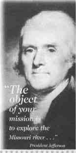
Lewis and Clark and Later Routes There should be no doubt that the primary purpose of Lewis and Clark's expedition was to establish just such a corridor. President Jefferson's instructions on this point were unmistakable. "The object of your mission is to explore the Missouri river, & such principal stream of it, as, by it's course and communication with waters of the Pacific Ocean, may offer the most direct & practicable water communication across the continent, for purposes of commerce." While the expedition's leaders had little interest in town sites and, of course, no knowledge of railroads or superhighways, they were specifically instructed to look for a route that would make money for those who used it. In this respect, their mission had only short-term success. Other explorers and other western travelers frequently used some of the expedition's route, but real and lasting trade routes-and the corridors that would develop along with them-were almost entirely the result of post-Civil War railroads and the wave of town founding that went with these railroads.
In 1854 Congress established the Pacific Railroad Survey. This was, in fact, a series of
Thomas Jefferson 41 detailed explorations that would prove to have a far more lasting impact on American geography than did Lewis and Clark. The surveys were, for the most part, conducted by the United States Corps of Topographical Engineers. Five transcontinental routes were recommended. Each has traditionally been identified by the parallel of latitude that it approximately follows. From south to north these were the 32nd parallel, 35th parallel, 41st parallel, 47th parallel, and 49th parallel. Of these routes, the 47th parallel most closely resembled the route taken by Lewis and Clark. Isaac Stevens, the governor of Washington Territory (1853-1857), laid out the 47th parallel, route. This later became much of the route taken by the Northern Pacific Railroad. Stevens was also in charge of the northernmost, or 49th parallel route. There is only a superficial resemblance between the route taken by Lewis and Clark and that later taken by the Northern Pacific Railroad.
The Northern Pacific was from the start conceived as a route from the Great Lakes to the Pacific—Duluth, Minnesota to Tacoma, Washington. However, only when the railroad reached the Missouri River, where they established the town of Bismarck, does the route taken by the Northern Pacific even intersect that taken by Lewis and Clark. West of Bismarck the two routes again diverge. Lewis and Clark crossed what is today northern North Dakota and Northern Montana, while the Northern Pacific crossed central North Dakota and southern Montana. The largest cities— Billings, Bozeman, and Butte—are all located along the railroad, not the Lewis and Clark route. Likewise, the only east-west interstate highway across North Dakota and Montana, I-80/I-94, follows the route taken by the railroad rather than the Lewis and Clark route. The Great Falls might seem an exception to this pattern; after all the explorers discovered the falls. However, when they discovered the falls, Lewis and Clark were following the Missouri River toward the southwest. The town of Great Falls was laid out by the Great Northern Railroad where it crossed the river on its way due west. Therefore, for the first two-thirds of their journey westward, later routes and corridors are very different from the path taken by the explorers. Nor is the western end of the explorer's route of lasting geographical importance. In a section of central Oregon, both railroads and later federal highways parallel the route taken by the explorers. However in both eastern and coastal Oregon, later corridors diverge significantly from the route. Lewis and Clark wintered at Fort Clatsop near the mouth of the Columbia River. This was on the south side of the river about fourteen miles from its mouth. Simple logic might seem to dictate that the mouth of the Columbia River-by far the largest river of the northwest-would be the location of the major metropolis in the regions, but this has never been the case. Astoria and Warrentown, Oregon, are pleasant places but have always been small when compared to Portland. The reason for this is that the urban network of the entire northwestern quarter of the United States owes its origin not to the period of initial exploration, but to the much later railroad epoch. Railroads and Towns On the first page of the preface to his study of towns and railroads John Hudson makes a point that students and scholars too often forget. He writes about urbanization. "Understanding of success requires an understanding of failure." In other words, students of the landscape must be constantly alert never to look at a successful town and then to seek geographical reasons for that success. If they do this, it is axiomatic that they will always find these reasons; it will always appear certain that a successful town had to have developed in this particular location. It is only when one 42 looks at both successful and unsuccessful towns that one comes to realize that equally compelling reasons may be compiled for a certain success of places that turned out to be disastrous failures. Hudson has also written, with only slight exaggeration, "It took a fair amount of ineptitude to loose money in a railroad town site up through the 1880s." In fact, successful towns have always been as much the result of human effort as of an ideal locational choice. The north Pacific coast of the United States illustrates that point. One of the dangers confronting students is trying to draw conclusions from small-scale maps. On a map where the entire United States is presented on a single page, it is evident that today Portland, Oregon, near the mouth of the Columbia River, is the largest city in the state. From this it is an easy jump to the conclusion that this location is somehow related to the activities of Lewis and Clark. In fact, the historic core of Portland is on the Willamette River, about ten miles from its junction with the Columbia and about 125 miles from the sea. This may not seem like a great distance, but consider the following. If we were trying to pick the square mile where the city were to develop using only the criteria that it had to be one of the square miles next to the Columbia within 125 miles of its mouth or on the Willamette within ten miles of its junction with the Columbia, and remembering that each river has two sides, we would be dealing with an area of just under 270 square miles. (There would be a little overlap between the two zones.) In other words, chances of guessing the location of successful place using the above criteria would be something like 270 to one. In fact, because most original town sites were much smaller than one square mile, the odds would be even greater. Hundreds of other places in Oregon and Washington meet the same criteria that we have used to explain Portland's success. In fact, the dominance of Portland was not the result of early discovery, nor was it foreordained by the pattern of rivers and mountains. Portland's regional importance was largely the result of manipulation by nineteenth-century railroad-related real estate speculators. In this case it was the men who came to control the Northern Pacific Railroad. Originally the railroad was to turn northward and have its Pacific terminus at Tacoma, Washington. However, when Henry Villard, a man whose financial interests were concentrated in Portland, managed to gain control of the railroad, he was able to shift its western focus to what must originally must have seemed a much less likely place. Portland boomed as a result of this manipulation. All of this took place in the 1880s, long after Lewis and Clark had become distant memories. There is another consideration. The success of a corridor depends not just on the shortness of the route, but on the ability of the corridor to capture tributary area. The geographer James E. Vance Jr. has coined an apt phrase for this process. He writes of "...the substitution of the geography of railroad competition for the more straightforward geography of terrain minimalization that had characterized and guided the Pacific Railroad Survey of the 1850s." In other words, finding the easiest route had become less important than capturing the largest tributary area. In this respect the Northern Pacific was a particularly successful railroad. In classical corridor fashion it was able to drawn in resources from a wide area and exploit them for the benefit of its own particular route.
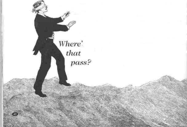
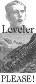
Of Low Gradient Routes One of the great ironies of the Lewis and Clark expedition is that it narrowly missed finding the very best-that is the lowest gradient-route across they Rocky Mountains. Curiously, Meriwether Lewis almost certainly knew that he was not following the easiest, or lowest gradient route to the Pacific. Indians had evidently correctly told him that the best pass would be found by following the Missouri River westward, proceeding up its tributary the Milk River, to the Marias River (which Lewis had named for a cousin, Maria Wood), and then over what became known as the Marias Pass. On their return journey the expedition split into separate groups, one of which was lead by Lewis. He explored to the upper Mirias River, but he seems to have been more interested in finding possible grounds for pushing the boundary of the United States northward than in locating a better pass across the Rockies. Unfortunately for Lewis, the region of the Milk and Marias rivers was tightly controlled by very hostile Black Foot Indians. Just short of the pass, he turned back and rejoined Clark's group. Much later, surveyors working for the Great Northern Railroad located the pass. Their railway, finished in 1893, would soon follow this pathway because every rise and fall adds considerably to the cost of operating a railroad. Indeed, the individuals who selected the routes' earliest canals were not called engineers but "levelers," those who found and maintained the lowest gradient route. Such a route was followed by the Great Northern Railroad, which was probably the most efficient of the transcontinental railroads. However, from the standpoint of locating large new cities, the Great Northern came too late. Cities further south, along the Northern Pacific route, were already too well established. 43
Conclusion It seems clear that, despite their courage, the route taken by Lewis and Clark had minimal influence on the present-day geography of the American Northwest. The trail they blazed was greatly influenced by political conditions in the first decade of the nineteenth century. While intended as a future trade route, their path was intended be a seasonal one. One cannot find a close link between present-day urban locations and the explorer's route. Patterns of cities and related bundles of transportation routes generally characterize American geography and these corridors often have distinct historical roots. Such corridors can be seen in the Northwest. However, rather than the route followed by Lewis and Clark, they are much more likely to follow the routes of late-nineteenth century railroads than the route taken by those two intrepid explorers. 44 |
|
|