|
Home | Search | Browse | About IPO | Staff | Links |
|
Home | Search | Browse | About IPO | Staff | Links |
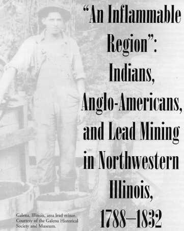
Virginia Jelatis By 1768 the Sauk and Mesquakie Indians had settled along the Mississippi River between Rock River to the south and Turkey River to the north. The Sauk and Mesquakie relocation to this area was part of a great series of migrations from the East, as the growing European population pressured native peoples to move west to avoid conflict over land and resources. This migration, however, only delayed the problem. Within fifty years the Sauk and Mesquakie, along with other native groups already in the area, would again be faced with encroaching populations. Over the next fifty years these Indians, along with other native groups already in the area, fished, farmed, hunted, and extracted lead from the nearby hillsides. Indians sold the surplus food, furs, and lead to French, British, and later American traders in exchange for finished goods that they could not produce themselves. In the 1820s, however, conflict erupted as American miners flocked to the area, hoping to strike it rich in the Indian-controlled lead mines. This Lead Rush created tensions with the natives, disrupted hunting and farming patterns, and ultimately forced the Sauk and Mesquakie to relocate once again, this time west of the Mississippi. 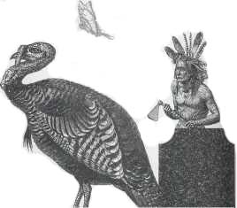
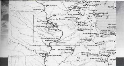
The Sauk and Mesquakie Indians settled into several villages on the east side of the Mississippi River. The main villages for the Sauk were located along the Rock River, at Des Moines Rapids, and at the Henderson River area. The Mesquakie Indians had one village at Rock Rapids, another near present-day Dubuque, and a third near the Turkey River. The Winnebago Indians were neighbors to the east, settling along the Wisconsin River (See Figure 1). In addition to hunting, fishing, and agriculture, native peoples in the area extracted lead from the nearby hillsides. The lead was used to create ornaments such as beads, buttons, jewelry, and pendants. Some lead was ground into powder, mixed with dyes, and used to make sparkling paint and cosmetics (See Figure 2). Lead was also used as an item of trade with other native groups, and later with Europeans and Anglo-Americans. 2
Before the arrival of Europeans this lead was not mined but rather scraped at the surface using bone tools. Lead was packed into deerskin bags and then sent on for trade or use by local native groups. Often it was the women and older men who worked the mines in the summer months, while younger men hunted for food and furs. The French introduced tools that made digging easier, and they taught the Indians to smelt the lead, a process that melted the ore to remove the impurities. By the late 1600s the Indians were working with the French, who actively cultivated lead mining and trade. From this lead, the French would make ammunition and other finished products to sell back to the Indians and to export to other areas. The mining operations intensified in 1788 when Julien Dubuque secured a grant from the Mesquakie to work the lead mines along the Mississippi River. Dubuque did not do the mining himself but rather depended on his French employees and the Mesquakie Indians. Dubuque set up a trading post of sorts, collecting furs and lead, and shipping these commodities down the river to St. Louis, and providing food and other items of trade to the Indians By the time of Dubuque's death in 1810 the lead trade was a well-established part of Indian life. The Mesquakie Indians continued to work the mines from the Dubuque community down to The Point (present-day Galena). The Winnebago Indians explored lead deposits along the Wisconsin River. The Sauk Indians from Rock River traveled north in the summer to work in the lead mines, bringing their share of ore home to exchange with traders in their area. While the Indians still hunted and traded in furs, lead was also an important exchange commodity, and they guarded their mines against Anglo-American encroachment. After Dubuque's death, for example, the Mesquakie Indians burned his house and other buildings and banned Anglo-Americans from their lands. Trader John Shaw, who shipped trade goods from Prairie du Chien between 1815 and 1820, asked to see the lead mines near Fever River (present day Galena River). At first he was denied access, but because Shaw was fluent in French, he was presumed to be a Frenchman and allowed to tour the Fever River area. When Anglo-Americans were allowed into the lead region, it was often because they married into Indian families. George Hunt, for example, set up shop just south of the Dubuque mines in 1811. He was a government appointee charged with trading American goods for lead. He married a Sauk-Mesquakie wife by the name of Pasoquey. Dr. Samuel Muir, who opened a trading post in 1819, married a Sauk-Mesquakie woman named Mawwaiquoi. Jesse W. Shull, A.P. Van Metre, and Amos Farrar also married Mesquakie women and set up trading stores in the lead-mining areas. A map published in 1822 included the site of a "Trader Village," a combination of stores and cabins located near The Point. These newcomers posed less of a threat to the native population because they became family members, adopting certain native customs. In addition, they did not work in the mines, they simply traded for the ore. The Indians retained control of the mining process during this period. Old Buck, for example, and his wife controlled several sites and at least twenty smelting furnaces. Amos Farrar estimated that Buck, a Mesquakie Indian, produced several million pounds of ore 3 
from just one of his sites. Buck's most dramatic find was in 1820 when he unearthed a chunk of lead so massive that, according to some sources, it took every member of the community to lift it. Other Indian groups along the Mississippi and Fever Rivers were also mining lead, then selling it for guns, ammunition, knives, cookware, blankets, and tobacco. By retaining control of the mines, the Sauk and Mesquakie were guaranteed a means of trade, as lead was an important currency in the region. One historian estimates that for the Mesquakie and Sauk in the Rock River area, the income from lead financed about 10 percent of the goods purchased from traders. For the Mesquakie Indians further north, lead ore financed from one-half to three-fourths of the items purchased from Anglo-American traders. As long as Indians worked the mines and Anglo-Americans served only as traders, the two groups lived in relative harmony. In the early 1820s, however, this harmony was disrupted as the U.S. government focused its attention on the mineral resources of northwestern Illinois. In 1807 the American government passed a law preventing the sale of public land containing valuable minerals and ores. The government believed it would make more money by leasing the land rather than selling it. In 1822 government officials began leasing the valuable land in northwestern Illinois. Although much of the Sauk-Mesquakie land had been claimed by the U.S. government in the Treaty of 1804, many Indians did not recognize that treaty as valid. Moreover, the Winnebago argued that their land had never been ceded and that the government had no right to lease their land to miners. The tension over land intensified as Native Americans were soon faced with an influx of Anglo-American miners, soldiers, and traders. The first wave of miners were temporary residents, remaining in the area only long enough to mine, then leaving for the winter months. An 1823 summer census recorded seventy-four miners (some with African American slaves) in The Point. Soon, however, people in St. Louis, southern Illinois, Indiana, and Kentucky were reading about the lead mines of northwestern Illinois. The population of the mining community grew from two hundred in 1825 to one thousand the following year (see Table 1). In 1826 The Point was renamed Galena (the name for high-quality lead), and the town became the unofficial center of the lead-mining region. The Lead Rush of the 1820s brought with it all the usual suspects. Miners covered the hillside with temporary dwellings. Saloons, dance hall girls, shopkeepers, and boarding-houses were not far behind. While some individuals came with money prepared to invest and develop companies, employ workers, and engage in large-scale mining operations, many of the prospectors were the stereotypical "frontier ruffians." A letter published in 1828 in Galena's newspaper, The Miner's Journal, complained that the area was attracting "thievish, poor, dirty, low-lived, rough scuffs, of eternal perdition" that came to Galena to escape a shady past. A woman writing to her friend remarked, "There is no morality here. Drinking, Swearing, and Carousing is the order of the day. I have frequently been asked where I thought Hell was located. I think I could answer the question now. I believe it is here." Although many did not intend to violate Indian mining or land claims, there was no order to the initial burst of prospecting. Prospectors trespassed on Indian land, mined in areas already worked by Indians, and disregarded Indian complaints. Winnebago and Mesquakie Indians continued to work mines, but tension between Anglo-Americans and Indians often boiled over into conflict. Miners would destroy Indian fields by turning loose horses and oxen to graze in the area. Indians would destroy mining tools, hoping to sabotage the efforts of the encroaching miners. Indians also policed their claims in an effort to retain control, but the offenses continued. One scholar estimates that by 1827, two thousand miners had crossed into lands claimed by the Winnebago. Lewis Cass, Territorial Governor of Wisconsin, summed up the situation in 1828 when referred to the lead mining area as "an inflammable region." 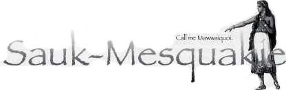
The increased population disrupted Indian life in other ways as well. Indian trails were quickly converted to wagon and horse trails. Smelters, who needed lumber to stoke the fires necessary to melt ore, cleared nearby forests. As the community attracted more permanent settlers, more land was cleared to build farms and towns. To protect the settlers and oversee Indian-Anglo-American relations, military personnel was sent to the area. All of these changes disrupted environments for deer, raccoon, birds, and other wildlife. Hunting patterns of the Sauk, Mesquakie, and Winnebago changed. Indians were forced to travel further, upsetting Indian and non-Indian neighbors. The Sauk, in particular, found it increasingly difficult to travel north for their summer mining, and the lead that they 4
depended on as currency became difficult to secure. Armed conflict came in 1827 during the Winnebago Uprising, as Winnebago from the Prairie du Chien area sought revenge for a number of grievances. White miners infringed on their claims, and Winnebago complaints had gone unanswered. The Indians were also upset about the murder of Winnebago prisoners at Fort Snelling, in present-day St. Paul. After a small group of Winnebago attacked setters at Prairie du Chien, residents throughout the region feared further Indian hostilities. Miners abandoned their claims and settlers deserted their homesteads, all heading to Galena for safety. Local militia and federal troops were quick to arrive, and the Winnebago refrained from further aggression. As a consequence of their actions, the Winnebago lost title to their lands in the Lead Region, opening up even more land for American miners and settlers. The mining industry suffered in the years 1829 to1832. One reason for the decline was the continued tensions among native peoples. The Sauk, Mesquakie, and Winnebago clashed with their traditional enemies, the Menominee and Sioux, disrupting life for settlers and miners. Tensions between Indians and settlers also continued. In 1832, for example, Black Hawk led a band of Sauk Indians in an effort to regain control of their land along the Rock River. Settlers in the area had taken over Indian corn fields, established communities along the Mississippi River, and made it impossible for the Sauk to continue their patterns of farming, hunting, mining, and trade. The Sauk were unsuccessful, however, and Black Hawk's band was relocated west of the Mississippi.
Following the removal of the Winnebago in 1828 and the Treaty of 1832 that ended the Black Hawk conflict and ceded Sauk and Mesquakie lands, lead-mining operations took on new life. Miners, settlers, and farmers populated lands formerly controlled by Native Americans, and Galena's lead industry increased significantly. Within fifteen years the area was producing roughly 90 percent of lead used in the United States. It is estimated that most of the lead-shot used in the Mexican-American War came from the Galena area. What was once part of the Native American economy and trade was now part of the industrial growth of the United States. The lead mines proved to be a central point of interaction for Anglo-Americans and the Sauk, Mesquakie, and Winnebago Indians. In the early years of contact, traders married into Indian families and traded finished goods for lead. Indians maintained control of the mines, with occasional support from Anglo-American neighbors. The Mesquakie and Winnebago lived nearer to the mining areas, but the Sauk from the Rock River area also depended on summer mining opportunities to supplement their trade options. The Lead Rush of the 1820s, however, changed the pattern of interaction. Miners, settlers, and military personnel encroached on native lands and mine claims, leading to tensions, conflict, and finally the loss of more Indian lands. Lead mining in the area would continue for generations, but after 1832 Native Americans were no longer a part of the landscape. 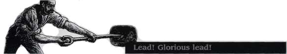
Timeline Pre-History — Native peoples in the Upper Mississippi Valley extracted lead, using it to create ornaments such as beads, buttons, jewelry, and pendants. Some lead was ground into powder, mixed with dyes, and used to make sparkling paint and cosmetics. There is also evidence to suggest that lead from the Upper Mississippi Valley was traded to other native groups across North America. Burial mounds in Mississippi, for example, dating back to roughly 100 A.D., contain projectile points and pieces of lead from the northwestern Illinois region. One of the oldest burial sites in southern Ontario was also found to contain lead from this area. 1660 — First written evidence of lead in the Upper Mississippi River Valley: Pierre Radisson made notes about a lead mine on the east side of the Mississippi River across 5 
from present-day Dubuque. For the next 100 years the French and local Indians developed a casual exchange of lead for European trade goods. 1768 — Sauk and Mesquakie Indians settled along Mississippi River, between Rock River in the south to Turkey River in the north. 1788 — Julien Dubuque secured a grant from the Mesquakie to work the lead mines along the Mississippi River. 1804 — Sauk and Mesquakie, coerced into signing a treaty ceding land between Illinois and Mississippi Rivers, are told they can stay on the land until the U.S. government needed it. Most Indians did not recognize this treaty as valid. 1807 — American government passed a law preventing the sale of all public land containing valuable minerals and ores. The government believed it would make more money by leasing the land rather than selling it. Lead region of northwest Illinois fell into this category. 1810 — Julien Dubuque died; Mesquakie try to keep Anglo Americans out of the area and away from lead mines. 1811 to 1822 — Americans begin to settle in area, mostly as traders; many marry into native families, collect lead and furs in exchange for arms, ammunition, cooking utensils, blankets, knives, etc. Indians still in control of lead mining; Americans serve as traders. 1822 — U. S. government officials began leasing the valuable land in northwestern Illinois. 1823 — American miners and prospectors begin to arrive in area. 1824 to 1828 — Lead Rush brings in thousands of miners, shops, boardinghouses, and taverns, followed by settlers, farmers, military personnel, etc. Tensions escalate between Indians and encroaching Anglo population. 1826 — Town of Galena established. 1827 — Winnebago Uprising: Armed conflict between Native peoples and American settlers over a number of issues including control of lead mines; as a consequence of their actions, the Winnebago lost title to their lands in the Lead Region. This opened up more mining land for Anglo American settlers. 1832 — Black Hawk conflict: As a result the Sauk and Mesquakie lose title to more land, and are required to relocate west of the Mississippi River; opened up more mining land for Anglo American settlers. Post-1832 — Lead mining industry thrived, now controlled by American miners.  Mark Newman Overview Main Ideas The relations between the Indians and Euro-Americans in the lead-mining region of present-day northwestern Illinois and southwestern Wisconsin represented one pattern of interaction between these two people. Exploring that pattern of interaction provides insight into a major theme of United States history. Lead was a primary trade good of the Indians and the French, becoming an important part of Sauk and Mesquakie life. The movement of Anglo-Americans into the region in the period from approximately 1800 and 1830, combined with U. S. land policies regarding ownership and mineral rights, sets the stage for the Lead Rush of the 1820s. As more Anglo-Americans settled in the region and mined lead, tension between the Indians and the newcomers eventually erupted into conflict. As part of President Andrew Jackson's administration's policy of Indian removal, the Indians of the region were relocated west of the Mississippi River. Lead mining continued, but the Sauk, Mesquakie, and other indigenous peoples no longer participated. Connection with the Curriculum This material would be useful in United States history, Illinois history, geography, sociology, anthropology, economics, and government. These activities may be appropriate for the following Illinois Learning Standards: 14.A.5, 14.D.5, 14.F.5, 15.A.5b, 15.C.4a, 15.E.4a, 16.A.33, 16.A.3b, 16.A.3C, 16.A.sa, 16.A.5b, 16.B.33, 16.b.5b, 16.C.3a, 16.C.4b, 16.c.5b, 16.D.33, 16.E.33, 16.E.4b, 17.A.3b, 17.A.4b, 17.C.33, 17.C.5C, 17.D.3a, 18.A.5, 18.B. 3a, 18.B.3b, 18.C.3b. Teaching Level Grades 6-12 Materials for Each Student
6 Objectives for Each Student
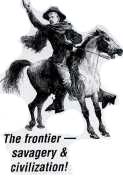
Opening the Lesson Introduce the topic of mining and the meeting of peoples. Introduce the following two theories of the frontier and the meeting of peoples. In the 1890s historian Frederick Jackson Turner presented his "Frontier Thesis." He saw the frontier as the meeting place of savagery and civilization. A succession of Euro-American frontiers, including trader, miner, and farmer, contributed to the development of United States civilization. The native peoples were considered uncivilized and part of the frontier wilderness. They were removed as the successive frontiers built civilized society. In the 1990s, historian Richard White studied the interaction of peoples in the Great Lakes region and presented the "middle ground" theory. White defined the middle ground as the geographic place and the social terrain where Indians and Euro-Americans interacted. He suggested that both peoples initially considered the other as alien and inhuman. Over time, each people adjusted to the presence of the other, developing methods of accommodating each other to gain benefits from the interaction and to address new social realities. White saw the middle ground eventually leading to the defeat of the Indian peoples. Explain that the activities on this topic will attempt to see which of the two theories fits the interaction in the lead mining region, or if neither applies. Developing the Lesson While it is recommended that the three activities be part of a single lesson, it is possible to separate them and do one or more independently. Activity 1 explores the two theories and has students examine the timeline and maps to gain a context for people, place, and time. It also has students develop questions to focus their reading of the essay. Activity 2 has students read and analyze the essay to answer the focus questions. It also has them refer to the map and timelines to enhance understanding. Activity 3 is a student debate of the two theories to decide which, if any, apply to the experience in the lead-mining region. This activity challenges students to evaluate their perceptions of Indian-Euro-American interaction. It also requires them to apply historical theories to a case study and evaluate their viability and applicability. Students can refer to their textbook, the essay, the timeline, and the map for information. Concluding the Lesson A post-debate discussion could focus on how the students' ideas of Indians may have changed and how their ideas on how Indians and Euro-Americans interacted may have changed. Extending the Lesson 
Since many history texts and classes neglect study of Indian peoples after 1900, it might be important for the teacher to note the present-day presence and activities of the Sauk, Mesquakie (also known as the Fox), Winnebago, and other Indian peoples. The teacher and students could Assessing the Lesson Activity 1 involves creating a Venn Diagram to compare and contrast the two theories. The Venn Diagram can be an evaluation instrument. In addition, student reading and analysis of the timeline and maps can be assessed by their answers to the inquiry questions and, if developed by the students, the focus of questions for the essay reading. Activity 2 can be assessed by the student responses to the focus questions that guide the reading of the essay. Activity 3 is the debate. The preparation and presentation of the debate can be assessed using a rubric. 7 
There are various historical interpretations of the settlement of the United States by Europeans and Euro-Americans. Two prominent theories are the frontier thesis by Frederick Jackson Turner developed in the 1890s and the middle ground by Richard White developed in the 1990s. The Frontier Thesis Frederick Jackson Turner saw the frontier as the place where European and United States civilization met Native American Indian savagery. He suggested there were several progressive frontiers that arose as civilization developed, including the trapper frontier, the miner frontier, the farmer frontier, and others. While he claimed that the miner frontier characterized the region of the Rocky Mountain westward, mining played a major role in northwestern Illinois in the early 1800s, Turner claimed that the ultimate result was the rise of civilization and Euro-American supremacy and the destruction of the frontier and Indian societies. The Middle Ground In his 1990s study of the meeting of Europeans and Native American Indians in the Great Lakes region, Richard White suggested that the region was a middle ground. The middle ground was defined both by geography and the social terrain of interaction between the two peoples. White claimed that Europeans and Indians considered the other as savages. He suggested each adjusted their cultures and developed accommodations to gain benefits from the other people and to adapt to new realities. The end result, White claimed, was the defeat of Indian societies.
8 

9 Activity 3 Divide the students into three teams for a debate on the theories explaining the meeting of Euro-Americans and Indians in North America and how they apply to the relations in the lead mining region. One team will defend the Turner thesis on the frontier, another will argue White's idea of the middle ground, and the third will suggest that neither offers a good explanation. The third group may develop its own theory. Debate organization: The debate involves an opening statement by each team, a round of questioning, and closing statements by each team. The debate format is opening statements followed by questioning round. Then teams will have 5-10 minutes to develop a closing statement based on their position and any information from the other debate components. Teams will choose spokespeople to deliver the opening and closing statements, but any team member may participate in the questioning round.
10 |
||||||||||||||||||||||||||
|
|


 visit the web site of the National Museum of the American Indian