|
Home | Search | Browse | About IPO | Staff | Links |
|
Home | Search | Browse | About IPO | Staff | Links |
|
LINEAR RECREATION WAYS By Robert D. Espeseth As park and recreation practitioners, we have all too often had fixations that land for recreation and parks should be in neatly blocked areas. There is often an over-concern for odd shaped parcels, "inholdings" and potential problems with adjacent land owners. We, of course need to provide the large, neatly blocked areas for parks, open space and recreational facilities as an integral part of the comprehensive plan for a park system. However, with the accelerated demand for lands and facilities to meet leisure time needs we must also take a more comprehensive look at our communities to see if joint or cooperative use might be made of particular types of land, such as various rights-of-way, or lands in more lineal patterns. Unused or underused rights-of-way (ROW) exist in most urban areas. We should be aware of these unusual opportunities which often exist right under our noses without being recognized. There are many types of ROW which should be investigated, including power lines, canals, abandoned railroads, highways, streets, levees, water supply connectors and reservoirs. Most of these linear patterns lend themselves best to trails for hiking, hiking, horseback riding, snowmobiles or even mini-bikes and all-terrain vehicles. There are often opportunities for nodular park developments associated with linear corridors. The corridors can be effectively used to connect existing parks or new areas acquired adjacent to the corridors to serve neighborhoods. Use of a single parcel of land for two or more public service purposes obviously requires less land and concentrates the burden of use of these lands on a single geographic area. The multiple use of ROW becomes even more desirable when these uses result in reduced effects on environmental values. Past conflicts between the technician (i.e., ROW agent, engineer, or route planner) and the conservationist, with the desire of the technician to avoid confrontation, has often resulted in concealed ROW acquisition plans. This has not only prevented early opposition by conservation-ists but has also precluded disclosure of ROW acquisition plans to potential multiple users as well. Recreation agencies, as an example, are rarely an integral part of such long-range planning and only obtain use of these corridors upon abandonment or as an after-the-fact tenant. It would be far more advantageous for recreation agencies to be a part of the initial planning and implementation so that the proper legal instruments related to acquisition can be used to insure recreational opportunities. One of the best ways to survey the linear patterns of your area is to make a low altitude flight over it or carefully examine a set of recent aerial photos. The flight should be taken in the early spring or late fall so that heavy vegetation or deep snow does not obscure the sites. Aerial photos are normally taken at these times. They can be obtained from the local planning commission or through the Agricultural Stabilization and Conservation Service (ASCS) Office in your county. Some of the potential corridors will "pop up" very clearly when seen from a broad overview but were otherwise obscured from ground level observation. You can obtain information on power or pipe line routes from the companies involved and abandoned railroad locations or prospective abandonments from the Illinois Commerce Commission or the Federal Department of Transportation. The ownership status of special linear areas will require individual checking. In some instances states, local governments or regional planning agencies have inventories and examined available ROW as a part of their planning process. Illinois Parks and Recreation 24 May/June, 1974 Laws have been passed at the federal and state levels which provide funding to "establish and maintain foot paths and bicycle trails within highway rights-of-way." Some examples of existing or potential uses of linear recreation-ways in Illinois include: 1. Abandoned railroads a. The Illinois Prairie Path is probably the best example of use of an abandoned railroad ROW for recreation. About 30 miles have been preserved for trail use through the cooperation of the DuPage County Forest Preserve District, the Prairie Path Association, the Commonwealth Edison Company and communities along the way. b. The Green Bay Trail is on the old North Shore Line ROW, immediately adjacent to the active Chicago and Northwestern tracks. It is operated by a committee of citizens in cooperation with the villages of Glencoe, Winnetka, Highland Park, Wilmette and Kenilworth. 2. City Streets Streets are a ready source of recreational trails, although this media is pretty well limited to hiking. Some cities merely sign the streets with the approved bike symbol, while others provide lanes painted on the road surface or physical separations from motorized vehicles, such as curbing or bumper blocks. Communities which have designated bike systems on city streets include, Sterling, Decatur, Springfield, Champaign-Urbana, Chicago and Palatine. Some of them provide brochures with maps and points of interest noted. A self-guided bike tour of your community could be very interesting. In larger cities there are many miles of roadways in cemeteries which might provide tranquil bike routes if the agency or private organization operating the cemeteries would cooperate on a multiple-use program. Cemetery traffic is slow and intermittent and would provide a safe place to ride. 3. Canals, Irrigation/Sanitary Ditches and Drain-ways.
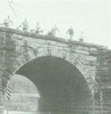
4. Airports If you stretch your imagination a bit the approach zones to airports could be considered linear in nature and they are prime for recreational use. The University of Illinois, Urbana-Champaign has a part of their golf course in an approach zone. It is particularly wise for recreation agencies to work with new airports in the initial planning stages so recreational use can be given early consideration. 5. Highways Recent legislation at the state and federal level provides funds for the development of hiking and hiking trails in association with highway ROW. So far there are no proposed projects in Illinois. Keep your eye out for potential projects and work through the nearest State Highway District Office in promoting this source of funds. Chicago and Miami, Florida, to mention two cities, have constructed park and playground areas under overpasses or raised sections of highways. This is often forgotten territory, with a ready made roof. 6. Power Line and Pipe Line Routes There are many instances where this valuable land resource has been utilized for neighborhood parks, trails or golf courses. There are many excellent opportunities where this mechanism could be used to good advantage but unfortunately isn't. It takes some good background work, with specific ideas for use, before going to the utility company with a proposal. Appeal to their public relations sensitivity and let them call the shots on publicity and news releases so they can gain maximum advantage of the public exposure. Be ready to work cooperatively with Illinois Parks and Recreation 25 May/June, 1974 LINEAR—WAYS the company but the park and recreation agency will usually have to take the first step in initiating such a program. The type of land control exerted by utility companies for these routes varies considerably and should be carefully determined. You must be willing to undertake a portion of the liability for use of the property. 7. Levees There have been several hundred miles of levees constructed in Illinois, primarily by the U.S. Army Corps of Engineers for flood protection. The levee systems offer ready made trails, often with exceptional views of rivers or bottom land forests. Many of these levees already have service roads constructed on them which would permit use immediately or after minimal grading. Contact the Corp of Engineers District office with local jurisdiction if there are usable levees in your area. They could be interesting links in a comprehensive trail system. 8. Reservoirs Usually you don't think of a reservoir as a linear resource but if you think of the shoreline around it, there is a linear relationship. Many utility companies, whether local in nature or more wide spread like Commonwealth Edison, have created reservoirs for portable water supply or cooling water for power generation. In many areas recreation has been a key element in their overall program and now the Federal Power Commission requires a recreational plan as an integral part of the license to operate such areas. Work closely with the utility companies if they have existing or proposed reservoirs in your area to insure that this resource will provide recreational benefits. Recreational use of lands adjacent to water supply reservoirs, and even use of the water surface itself, does not adversely affect the quality of water going into the water plant. Most utility companies do not wish to get into the "recreational business" but would prefer to work out agreements with local governmental agencies for operation of the recreational facilities. Linear recreation-ways present unusual opportunities to expand the types of recreational services offered in your community. Contrary to the feelings by some administrators, the property lines do not have to be fenced completely and supervision of the areas are not insurmountable. Control measures must be designed into projects of a linear nature in the same way as they are in most public projects. The best way to find out how to cope with some of the potential problems is to visit and talk to people who have successfully operated such facilities. The Bureau of Outdoor Recreation is keenly interested in fostering the idea of trails and innovative uses of the linear corridors. The
Illinois Parks and Recreation 26 May/ June, 1974 LINEAR RECREATION WAYS Illinois Department of Conservation is the state agency most closely related to the national trail program. There are many opportunities for effective use of ROW. These ROW may be relatively small in acreage but often are highly strategic in location. Check your community for these strategic sites!! (Editor's Note: Robert Espeseth is Outdoor Recreation Specialist for the Office of Park & Recreation Resources, University of Illinois.) Illinois Parks and Recreation 27 May/June, 1974 |
|
|