|
Home | Search | Browse | About IPO | Staff | Links |
|
Home | Search | Browse | About IPO | Staff | Links |
Overview
Main Ideas
Connection with the Curriculum
Teaching Level
Materials for Each Student
Copies of maps 1, 2, 3, and 4
Objectives for Each Student
Analyze political activity as it moves from conflict to compromise to new conflicts and new compromises. Defend/dispute the wisdom and integrity of Nathaniel Pope's actions.
Opening the Lesson
Developing the Lesson
After evaluating all three options, each group should agree on the location of the northern Illinois border and present and defend their decision to the class.

4
Concluding the Lesson
Extending the Lesson
Students will discuss political cartoons as the teacher or student leader records the cartoon's characteristics as they are identified. The teacher should ask students to discuss the different perspectives of Illinois and Wisconsin citizens in 1876 or today concerning the boundary separating the two states. Nathaniel Pope's earlier role as hero or villain might also be included in the discussion. Students should draw two political cartoons, one from an Illinois and one from a Wisconsin newspaper. The cartoons should reflect awareness of the characteristics of political cartoons, comprehension of the conflict, and understanding of the different viewpoints.
Assessing the Lesson
5
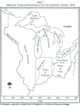
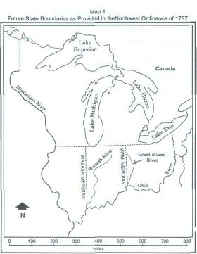
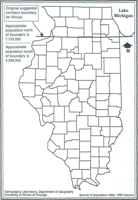
Option 1 proposes that the northern boundary of Illinois be established in accordance with the Northwest Ordinance of 1787, an east-west line touching the southern tip of Lake Michigan. As a delegate, you believe this makes the decision easy and you will leave for home by early afternoon.
The advantages of this option are:
The disadvantages of this option are: 6
You are not particularly satisfied with Option 1. The country is increasingly concerned with the balance between slave and free states. Nathaniel Pope, a delegate to Congress from Illinois, has suggested that the northern boundary of Illinois be pushed to the parallel of 42°30', approximately 31 miles north of the boundary suggested in the Ordinance of 1787 and farther north than the boundaries of Ohio or Indiana. Why is Pope so audacious?
The advantages of this option are:
The disadvantages of this option are:
7
Option 3 establishes the Illinois northern boundary even with Indiana's or Ohio's northern border. This option confuses your Congressional group. It seems that in 1803 a mistake was made, and the northern boundary of Ohio was set approximately six miles too far north. What was the mistake? You know the Michigan politicians are angry and will probably demand action or compensation. In 1816 your group had another headache. The northern Indiana boundary could remain as determined by the Ordinance of 1787 or it could be set even with Ohio's northern border. The Indiana group did not like either choice and eventually got the boundary pushed ten miles north. Why was this ten miles important to the Indiana group? The date is now 1818, and your group should consider the advantages/disadvantages of using this option for Illinois. Why did you bring up old history? You will not be leaving here for a week and the southern delegates are getting suspicious. They see a plot to make Illinois a strong northern state by pushing its boundary further north. The advantages of this option are:
The disadvantages of this option are: 8
9
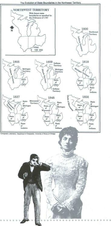
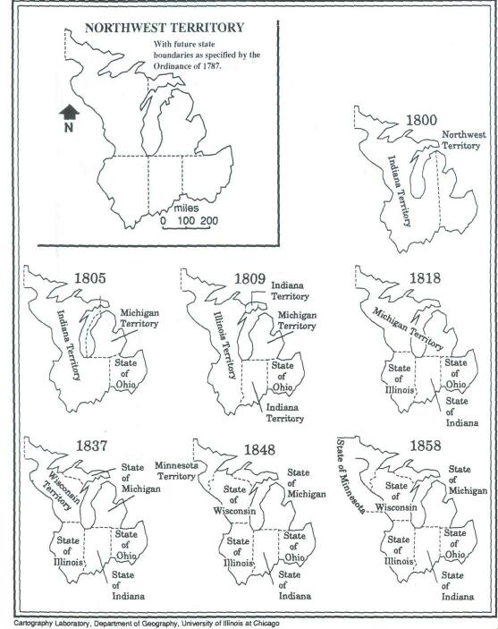
Map 3
The Evolution of State Boundaries in the Northwest Territory
10
Map 4
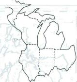
Illinois: Original Suggested Boundary and Final Result with 1990 Population of Each Area
Click Here to return to the Article
11
|
|
|