 |
Home | Search | Browse | About IPO | Staff | Links |
|
Home | Search | Browse | About IPO | Staff | Links |
Underneath It All
The Geological Survey wants to do a new map of Illinois focusing on the part of the state you can't see STORY BY GARY THOMAS PHOTOS BY JOEL DEXTER
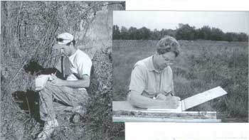
Geological Survey scientists Ardith Hansel, Dick Berg and Mike Barnhardt log cores during a sampling while doing mapping in the Antioch area. We're trying to promote smart growth, and understanding the state's geology is the first step in promoting smart growth." With that statement, Dick Berg launched into a conversation to convince me that doing a three-dimensional map of the entire state is the first step in putting together the information necessary for the smart growth he is promoting. It didn't take much convincing. He was armed with tons of statistics supporting his view, and the project made a great deal of sense to me. Berg is a geologist and director of the geological mapping program for the Illinois State Geological Survey, the agency which, among other things, serves as the focal point for the state's mapping efforts. What he was talking about is the Central Great Lakes Geologic Mapping Coalition, an effort of the geological surveys of four statesIllinois, Indiana, Michigan and Ohio-and the United States Geological Survey, to begin the process of developing three-dimensional maps, from land surface to bedrock, to deal with issues of land use. "This mapping effort isn't just for business or government," Berg continued. "We're concerned with the quality of life for people. This is about where business and industry can be located, where development can take place, where we can build recreation areas. We're mapping the way to economic growth and, just as importantly, for environmental security." The mapping will be done at a detailed scale of 1:24,000, where one inch on the map is 2,000 feet on the ground. Don't look for the job to be done overnight. Even if maximum funding was available right now, the project would take upwards of eight to nine years to complete. And that's just the initial phase of the project, comprising only about one seventh of the state. As you can see, mapping the entire state is a long, long-term project. September/October 2001 39
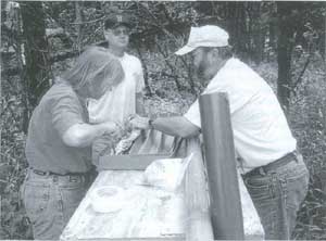
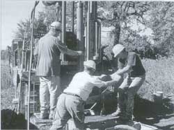
Charles Dolan,
Mike Barnhardt
and Steve
Wildman operate
the drill to collect
core samples in
Antioch.
Let's go back for a minute. Let's start at the beginning. Most of Illinois was shaped by glaciers during the past million or so years. These sheets of ice advanced and retreated across what would become Illinois, leaving thick, complex blankets of intermixed layers of mud, clay, silt, sand and gravel, dictating our agricultural soils, and the location of groundwater in aquifers and minerals. Three-dimensional maps will do more than just give us a look at our state from surface to bedrock. They will sort out and interpret the data, and highlight the areas that are subject to flooding, erosion, landslides, radon gases and earthquakes. The maps will point out where sedimentation is taking place and where water contamination is likely to occur. And while maps can't stop these natural events from occurring, the knowledge will provide the basis for locations where smart development can most beneficially occur while protecting and ensuring environmental preservation. This knowledge is needed for making the right decisions for a growing society. Keep in mind the decisions are going to be made, whether the information is available or not, Berg pointed out and many times, the decisions are bad choices. "In the early 1990s, about $85 million was spent to develop a low-level radioactive waste disposal facility in Clark County," Berg said. "However, they discovered they were planning this site above an aquifer that could have allowed potentially contaminated materials to spread. So after all those dollars were spent, nothing came from the project. If we would have had detailed three-dimensional maps prior to site selection, we would have known that an aquifer existed and would never have considered the site for such a facility." The same is true with Superfund sites. Berg said the average cost of cleaning up a Superfund site is about $15 million, but that many of them wouldn't have been located where they are had we known what was beneath them. There are numerous other examples of bad decisions being made because detailed information was not available. "It's impossible to always make the correct decisions as to how to use the state's resources," Berg said. "The more information we have, the better we can plan. Three-dimensional maps will tell us what lies beneath and provide the background so informed decisions can be made. They will let us know where to build and develop, where we can dispose of our trash, where our aquifers are located and where the possibility of erosion or earthquakes is the greatest. Maps will also support timber industries and help protect fisheries and wildlife habitat." The Geological Survey plans to focus its initial efforts on the Chicago, East St. Louis and Peoria areas, primarily because that's where the majority of our population lives. "That doesn't mean we're not interested in all parts of the state," Berg said. "We just had to start somewhere, so we chose to begin in those parts of the state where the most impacts have already taken place and where planned growth is imminent." The initial effort will map all of 10 countiesCook, DuPage, Grundy, Lake, Madison, Mason, Monroe, Peoria, St. Clair and Will-plus parts of eight othersChampaign, Jersey, Randolph, Marshall, McLean, Putnam, 40 Illinois Parks and Recreation Tazewell and Woodford counties. When the mapping of all these areas is complete, about one-seventh of the state will have been documented. The information won't come cheap. Berg said each of the four states is looking for federal funding to help with the mapping. He said the survey would require from $2 to $4 million per year for the next 10 to 15 years to complete the initial phase of the project. What's the value of this mapping effort? In the 1960s and 1970s, the United States Geological Survey conducted detailed mapping of the entire state of Kentucky at a cost of about $90 million (in 1999 dollars). However, those maps simply showed primary geologic materials at the land surface. They did not show all the materials from surface to bedrock as is being proposed here. The primary use of the Kentucky mapping was to be for energy and mineral development. However, the main use wound up being for water resources and environmental protection. Illinois recently did a study to find out the economic importance of the Kentucky mapping. Berg said the study concluded that the value of the maps to users was between 25 and 39 times the cost of doing the mapping. He belives what we're proposing today will be even more useful and valuable than the mapping done in Kentucky. We've pointed out what the mapping would do and why it is important to Illinoisans, but the mapping of Illinois and other Great Lakes states also is important from national perspective. The states include nearly 20 percent of the nation's land, and about 15 percent of the country's population. The states contribute half of the nation's heavy industry, one-third of the nation's corn and bean production, and include five of the 25 largest cities in the nation. "This is America's heartland, one of the most productive and economically important regions of the country," Berg said. "It's important to know about our geology for development, transportation and agricultural resons." If this project is so important, why wasn't it done long ago? That question can be answer with two words: expenses and computers. The Illinois State Geological Suvey has always had the ability to obtain some of the information neccessary to put this mapping program together. However, obtaining all of the needed information is very expensive. Drilling holes several hundred feet deep and obtaining samples as well as geophysical investigations (sending sound waves and difference in their rates and ease of travel) do not come cheaply. In addition, hundreds of thousands of bits of information must be compiled in order to assemble the information into maps that are easy to understand. It wasn't until computers became readily available that the Geo Survey finally had the means of assembling and putting the information together into comprehensive maps. "Geology is the foundation for ecosystems," Berg said. "The make-up of the land determines what you can do thereeverything from how many animals can live there to how much development the land can sustain. Mapping this foundation will provide us with valuable information that will become a part of our culture. Once available, it often will be taken for granted, but it will become important for industry, for developers, for agriculture and for individual landowners. This is important information, and making decisions will become a whole lot easier when this information is available, whether it's being used to place a factory or a recreation area."
GARY THOMAS
September/October 2001 41
Five selected to enter Outdoor Hall of Fame
"These five individuals, each in his own way, have helped make Illinois a better place to live, work and play through their dedication to the outdoors," said DNR director Brent Manning, who serves as chairman of the board of directors of the Illinois Conservation Foundation. "We can all draw inspiration from their efforts in protecting, promoting and enhancing the natural wonders of our state." The inaugural class of Illinois Outdoor Hall of Fame inductees are: Frank C. Bellrose, Havana, one of the world's foremost authorities on waterfowl and wetlands. His research career spans more than 50 years with the Illinois Natural History Survey. His books Ducks, Geese and Swans of North America and Ecology and Management of the Wood Duck both received Wilderness Society "Book of the Year" honors. He also is the namesake of the INHS Frank C. Bellrose Waterfowl Research Center near Havana. Jack Ehresman, Hanna City, outdoors columnist for the Peoria Journal-Star for 30 years until his retirement in 1997, part of a 45-year sportswriting career at the newspaper. Jack wrote more than 7,500 columns on outdoors activities and issues, receiving numerous state, regional and national awards for his insight into the needs and interests of hunters, anglers and conservationists. James Helfrich, Hammond, a 33-year employee of the Illinois Department of Conservation, who served as the agency's assistant director from 1977 until his death in 1986. A former state police trooper, Jim championed conservation education, preservation and expanded outdoor recreation opportunities as a Department of Conservation staff writer, administrator, legislative liaison and assistant director. The Department of Natural Resources' Helfrich Wildlife Propagation Center near Lincoln is named in his honor. The late John Husor, Willow Springs, award-winning sportswriter and columnist for the Chicago Tribune. From 1984 until his death in 2000, John was among the nation's premier outdoors writers. Through his columns and through personal contact with policy makers, he was a forceful advocate for wildlife restoration, hunting and fishing access in Illinois, natural resources protection worldwide and the life-enhancing value of spending time outdoors. Gene Morgan, Sesser high school biology teacher and founder of the Sesser-Valier High School Outdoorsmen's Club. Gene engages his students in conservation education through bird, plant and forestry management activities, wildlife research and recycling initiatives. His Outdoorsmen's Club members provide outdoor recreation opportunities to people with disabilities through activities including an annual deer hunt and participation in special events for youngsters with developmental disabilities in southern Illinois. The five were selected from among 41 nominees for the Illinois Outdoor Hall of Fame submitted by citizens from throughout the state. They will be inducted during ceremonies at the Illinois Outdoor Hall of Fame Banquet on Friday, Feb. 1, 2002 at Drury Lane in Oakbrook Terrace. The banquet will also feature a raffle, a 200-item silent auction and a live auction. Auction items will include a Triton bass boat, motor and trailer; a Tracker walleye boat, motor and trailer; a camouflage waterfowl boat with motor and trailer; a state parks lodge tour including accommodations and meals; and a variety of hunting and fishing trip opportunities. For more information on the Illinois Outdoor Hall of Fame Banquet, contact Ron Alien, Illinois Conservation Foundation, 524 South Second St., Springfield, IL 62701-1787, phone 217.785.9371. The Illinois Conservation Foundation, an IRS 501 (c)(3) not-for-profit corporation established in 1995, has raised more than $10.4 million to support the programs of the Illinois Department of Natural Resources. Contributions are tax deductible to the fullest extent of the law. For more information, contact Executive Director John Schmitt at 312.814.7237.
Peoria park gets name change
"This bill is a suitable way to acknowledge and honor Bill and Hazel Rutherford's contribution of Wildlife Prairie Park to the state of Illinois," Gov. Ryan said. "Their longtime commitment to conservation and the environment will be remembered for years to come." The state park is located in Peoria County and consists of 2,000 acres and more than 10 miles of trails. Established by the couple in the late 1960s, the park began as an endangered species breeding farm. Animals, including bison, deer, elk, black bears and cougars, still roam on the restored prairie.
Commission approves new nature preserves
Nature preserve dedications are: Hemmer Fen and Sedge Meadow Nature Preserve in Kane County, consisting of three wetland basins near the headwaters of the south branch of the Kishwaukee River and Coon Creek; and the 694-acre Singing Woods Nature Preserve in Peoria County, which is owned by the Peoria Park District. The addition to an existing nature preserve is 38 acres to the North Park Addition to Florsheim Park Nature Preserve in Lake County, owned 42 Illinois Parks and Recreation by the Village of Lincolnshire. The two land and water reserve registrations are: Chip-O-Will Land and Water Reserve, a 55-acre site in Washington County; and the Tri-County Wetland Land and Water Reserve, a 31.5-acre wetland owned by DNR in DuPage and Kane Counties. Illinois now has 299 nature preserves in 78 counties totaling 38,970 acres and 56 land and water reserves, in 39 counties totaling 21,556 acres. Landowners interested in preserving high-quality natural lands through nature preserve dedication or land and water reserve registration should contact the Illinois Nature Preserves Commission, 524 S. Second St., Springfield, IL 62701-1787 or phone 217.785.8686.
Report details status of Illinois ecosystems
Critical Trends in Illinois Ecosystems, published by DNR's Critical Trends Assessment Program, details findings of scientific data collection and analysis conducted since 1994 on the status of Illinois ecosystems. "This report provides an overview of land cover mapping, a biological inventory of resource-rich areas of the state, assessments of natural and man-made conditions in 10 major watersheds, and the results of ecosystem monitoring conducted during the last six years by scientists and trained volunteers," said DNR director Brent Manning. Among the report's highlights are the following. Agricultural land dominates the Illinois landscape, covering 77.5 percent of the state; forested and wooded lands comprise 11.3 percent (not including forested wetlands); urban, built-up and urban grasslands total 5.8 percent; wetlands cover 3.2 percent (bottomland forest is the most prevalent type ofwedands at 2.2 percent of the state's land area); and 2.1 percent is open water including lakes, river and streams. Thirty areas notable for their quantity of forests, wetlands, natural areas and biologically significant streams were classified as Resource rich Areas. They serve as the core of the states ecosystem partnerships with local groups and individuals, working to improve ecological and economic conditions in those areas under the auspices of the Illinois Conservation 2000 program. Stream habitat quality is generally fair to poor natural habitat features like wooded riparian corr(?) channels and stable stream beds. Many streams levels of organic pollution and siltation, with a lack of different aquatic insect and fish species. Disturbance of Illinois' forests and woodlands continues, with native trees such as oak and hickory being crowded out by maples, a less-desirable food source for wildlife. Non-native species, such as multi-flora rose, honeysuckle and garlic mustard, are taking over the shrub layer and forest floor. While prairie dominated 61 percent of the Illinois landscape prior to 1820, only 0.01 percent of original prairie remains in a high-quality condition. While almost 20 percent of the state is characterized as grassland, todays grassland is much less diverse than yesterdays prairie, with an average of only 20 plant species compared with 100 to 140 species in a high-quality prairie. Few high-quality wetlands remain due to siltation, changes in water flows, drainage and the presence of invasive, non-native plant species. Typical Illinois wetlands host only one or two species of wetland-dependent birds instead of the six to 10 species found in a healthy wetland environment. Copies of the 112-page, soft-cover book Critical Trends in Illinois Ecosystems are available by writing: DNR Clearinghouse, 524 South Second St., Springfield, IL 62701-1787, 217.782.7498, clearing@dnrmail.state.il.us. The report also can be read online by going to http://dnr.state.il.us/orep/ctap2.
Outlook dim for goose hunters
The estimated number of nests (176,584) was only 5 percent lower than last year, so it is believed most of the decline occurred in the estimate of non-breeding birds. The fall flight forecast is 697,142, down 46 percent from the 2000 forecast. The fall forecast also represents the second lowest forecast during the past 13 years, second only to the 1998 prediction of 651,796. "Numbers of non-breeding birds were down drastically from last year's numbers. Breeding pairs were similar," said DNR Director Brent Manning, noting that there were widespread nest losses last year along the Hudson Bay coast, evidenced by the fact that few flocks contained any goslings last summer. While harvest numbers are not yet available, biologists believe heavy snowfalls in parts of the wintering range may have contributed to above-average harvests throughout the Mississippi Flyway this past winter. If these numbers hold, Illinois could be facing a goose September/October 2001 43 season even more restrictive than 1998 and one that is dramatically reduced from the last two liberal seasons hunters enjoyed. Illinois' statewide quota for Canada geese in 1998 was 40,800 compared to last year's 127,000. DNR participates in a Mississippi Flyway Council meeting in late July, where Illinois' quota will be determined. Season dates and bag limits will be recommended by the three zone waterfowl hunting advisory committees after that and reviewed by the Natural Resources Advisory Board in August. The Council represents state, federal and provincial wildlife agencies from the central United States and Canada. These predictions are not expected to impact either the September nuisance goose season or the snow goose season.
Agencies join forces to battle kudzu
The Illinois Departments of Agriculture, Natural Resources and Transportation, along with the U.S. Forest Service (Shawnee National Forest), U.S. Fish and Wildlife Service (Crab Orchard National Wildlife Refuge, Cypress Creek National Wildlife Refuge) and the Natural Resources Conservation Service have joined in the unique partnership to eradicate kudzu in Illinois before the federally listed noxious weed becomes a major economic and wildlife habitat pest. "Many exotic species plague our state and kudzu may be the only one we have a better than even chance of eradicating," said Brent Manning, director of the Department of Natural Resources, whose agency is coordinating the action plan. "If we act now in cooperation with landowners and these agencies, while the kudzu population in the state is relatively small, we have a fighting chance." Manning said a three-year survey found fewer than 100 populations of kudzu in Illinois covering less than 400 acres, mostly in the southern one-third of the state. Biologists fear that the Illinois kudzu population may be entering what is known as an "exponential spread phase" seen in other states and could begin to spread rapidly. Kudzu covers more than seven million acres, primarily in the southeastern United States, and is spreading at a rate of 120,000 acres per year. It causes more than $300 million in damage each year to agricultural and forested lands, resulting in substantial losses of wildlife habitat and biodiversity. In Illinois' neighboring states, Missouri officials are beginning to address the growth of kudzu there, while kudzu has become so pervasive in Kentucky that officials believe eradication is not an achievable goal. The multi-year program will identify kudzu populations and contact landowners for their voluntary cooperation in the eradication effort. The agencies will coordinate planning and implementation of the initial and follow-up treatments and conduct subsequent monitoring. The services will be provided free of charge to private landowners. Eradication of kudzu on Department of Natural Resources properties is already underway. In addition, treatment has been initiated on approximately one-third of the known kudzu populations on private lands in the state. 44 Illinois Parks and Recreation |
|
|