 |
Home | Search | Browse | About IPO | Staff | Links |
|
Home | Search | Browse | About IPO | Staff | Links |
|
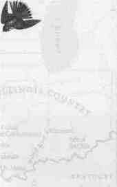
Robert E. Hartley Meriwether Lewis and William Clark left a sketchy record of what they accomplished during almost six months in the Illinois country from November, 1803 to May, 1804. Now, two hundred years later their documents, combined with fresh inquiry about people they encountered, provide an opportunity to appreciate the contributions of Illinoisans to the success of an extraordinary expedition. In 1803 the Illinois country was thinly populated and offered settlers or visitors few amenities. About thirty-five hundred French and American settlers, an unknown number of Native Americans, assorted wildlife, and domesticated animals lived in the region. Most residents clustered in settlements between the villages of Cahokia and Kaskaskia (near present-day Chester), and in St. Louis. The people lived near the Mississippi River, which provided transportation, nourishment, and access to goods and services. The center of United States population was hundreds of miles east and south, and the westernmost states of the Union were Kentucky and Ohio. Captains Lewis and Clark might be excused if they were not overly impressed by the Illinois country. They had advance information and probably knew what to expect, Clark visited Kaskaskia, Cahokia, and St. Louis in 1797 on a mission to straighten out the financial affairs of his older brother, George Rogers Clark. On that visit William met many of the men who became tutors of Lewis and Clark during the winter of 1803-1804. Both men had served as soldiers on the Ohio and Indiana frontier years earlier, so nothing much surprised them. If anything, they were pleased by the generosity and friendliness extended to the Corps of Discovery.
Many of the French residents were descended from the first white people to settle the country in the early 1700s. Of the Americans among them, most had arrived from places such as North Carolina, Georgia, Virginia, Tennessee, and Kentucky during and after the American Revolution. Traveling as families, mostly by rivers leading to the area, they brought the first true American flavor to the distant western United States and territories. Retail stores, especially in Kaskaskia and Cahokia, offered necessary goods and a few delicacies to settlers, hunters, and traders. One store's inventory included cotton cloth, Irish linen, eye glasses, knives, iron pots, razors, satin shoes, candlesticks, pencils, and pewter goblets. Residents derived a modest living from the fertile soil of the Mississippi River flood plain, known as the American Bottom. A few became wealthy trading with Indians and buying land cheap. Government services were minimal, and mail delivery was erratic. Alert to the risk and dangers of an untamed country, settlers learned from their experiences in various wars and skirmishes and at previous homesteads on the frontier. This was the way of life when Lewis, Clark, and their volunteers arrived. 29
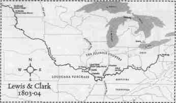
Lewis had been briefed in Washington, D.C., and Pittsburgh by sources familiar with the Illinois country, and he received the latest maps of the territory. Much of the information came from friends and resources of President Thomas Jefferson. The president conceived the expedition, obtained congressional approval, chose its leaders, and outlined the objectives. That preparation served Lewis and Clark well until they arrived at the Mississippi. Conversations with people in the Illinois country provided far better information about realities of the journey ahead. Documents and information the captains gathered during those six months shed light primarily on the first leg of the journey up the Missouri River the Mandan Indian villages, in an area now in North Dakota. From a variety of sources in the Illinois country, Lewis and Clark gained intelligence about the rivers and learned of Indian tribes, their cultures, and trade habits. However, the time of Lewis and Clark in the Illinois country is not only about the raw information and the people who provided it, but how the captains shaped it to their needs. For example, Clark used the information to draw a map of the west, and he estimated the distance to the Pacific and the time required for the expedition.
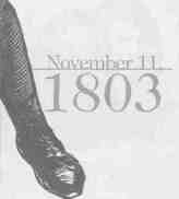
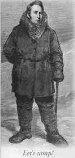
Lewis and Clark met to begin the journey—they were good friends before agreeing to lead the expedition—at the Falls of the Ohio River near Louisville, Kentucky, in October 1803. The Clark clan, including William and George Rogers, lived nearby. Two weeks later with nine crew members recruited in Kentucky, Lewis and Clark started down the Ohio in a keel boat and two pirogues (canoe-like boats). They first set foot on Illinois soil November 11, 1803, at Fort Massac on the Ohio River. The military outpost, originally built by the French at the extreme southern tip of Illinois, had about ninety residents, mostly soldiers. (The fort has since been reconstructed on land near Metropolis, Illinois.) The captains and crew stayed only a short time at Massac, but there they recruited one of the expedition's most experienced and talented guides and hunters, George Drouillard. After the Corps returned in 1806, Lewis called Drouillard "a man of much merit" who "uniformly acquitted himself with honor." Two other recruits joined at Massac. Slowly, Lewis and Clark followed the Ohio to its confluence with the Mississippi, stopping for several days at the site of Cairo and other points in southernmost Illinois. They took instrument readings, met with Indian tribes, and prepared for the journey on the Mississippi. On November 20 the party turned north for the strenuous boat trip to Kaskaskia against the mighty river's current. It took seven days with the crew at the oars most of every day to cover 93 miles. Complicating the journey was Clark's extended illness, which began as the Corps left the falls of the Ohio. His health did not improve until their stay at Kaskaskia.
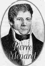
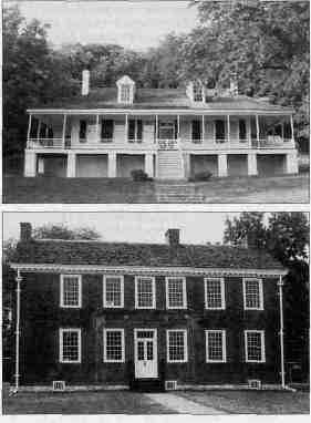
In 1795 Clark had traveled the Ohio on an army mission as far as where the two huge rivers merge, but the Mississippi River journey northward was unfamiliar country for the captains and crew. After stopping several nights on both the Missouri and Illinois sides of the river to camp and rest, they landed at Kaskaskia on November 28. Immediately, Lewis and Clark went to work on three objectives: gathering information about trade with Indians of the Missouri River region; recruiting more members of the expedition; and locating sources of food and supplies for the winter. Kaskaskia—a French settlement dating to the early 1700s—had about 450 residents, including successful and wealthy traders and landowners. The captains had an opportunity to meet the leading citizens, including traders John Edgar and William Morrison and the influential Pierre Menard, a French Canadian who became the state's first lieutenant governor in 1818. These men knew the 30
dangers and opportunities of travel in the Mississippi and Missouri river valleys. Edgar came to Kaskaskia in 1784 after being a prisoner of the British during the Revolution and later serving as a ship's captain for the U.S. Navy. He became a powerful politician and the largest owner of land in the region, Clark had met him in 1797 after traveling overland to Kaskaskia from Kentucky. Morrison moved to Kaskaskia from Philadelphia as a youngster in 1790 to establish a trading business. Known as the "Merchant Prince," he knew the trade routes from New Orleans to Canada. He established a relationship with Clark that continued for years after completion of the expedition. Menard had excellent contacts with the Spanish government in St. Louis and had built a successful business of his own. After the expedition returned in 1806, Menard and Morrison joined with veterans of the Corps, including Clark, in fur-trade ventures. The captains recruited additional expedition members from two United States Army companies stationed near Kaskaskia. Not all immediately joined the party, but Clark wrote to his brother Jonathan that twelve men signed up to accompany the dozen already recruited. By the end of their stay in Kaskaskia, volunteers numbered about twenty-five and included men whose names became familiar in the journals of the expedition: John Ordway, Charles Floyd, Patrick Gass, John Whitehouse, John Colter, and Nathaniel Hale Pryor.
With work at Kaskaskia finished about December 3, two tasks required immediate attention. First, Lewis needed to make contact with Spanish government officials in St. Louis to see if they would allow the expedition to proceed on the Missouri River. France still owned the vast region west of the Mississippi called Louisiana, and the Spanish governed the portion that included the Missouri River. Second, Clark, the party, and boats needed a location for winter camp, as frosty weather had arrived along the Mississippi. In his letter about the Kaskaskia visit, Clark indicated he too would have gone to St. Louis with Lewis but for his poor health. Lewis did not speak French or Spanish, so he took two interpreters from Cahokia with him to St. Louis: John Hay and Nicholas Jarrot. Highly recommended for their language skills, knowledge of the Mississippi Valley, and St. Louis contacts, the two met with Lewis in Cahokia, a town of about seven hundred people and the oldest settlement in the Illinois country. The connection with Hay turned out to be a godsend. His expertise in trade with Indian tribes proved especially helpful. Over the winter months Hay, who later helped organize the city of Belleville, and Lewis spent many days together and became good friends. Lewis had a cordial meeting with Spanish leaders in St. Louis, but they denied his request to travel on the Missouri. That meant the expedition needed to find winter quarters quickly. Jarrot, a trader and large landowner, offered Lewis the use of land he owned on the Dubois River (also called the Wood River) about twenty miles north of Cahokia. The Dubois flowed into the Mississippi almost straight east of where the Missouri merged with the Mississippi. A more convenient location for the Corps of Discovery to camp could not have been found. Other sites were considered, but Clark chose the Dubois location because of its proximity to the mouth of the Missouri. After leaving Kaskaskia, Lewis and Clark quickly fell into a pattern of dual responsibility that continued for the next five months. Lewis spent most of his time in Cahokia and St. Louis gathering information from such people as Hay, St. Louisans Auguste and Pierre Chouteau, their brother-in-law Charles Gratiot (a former 31
resident of Cahokia), and fur trader Manuel Lisa. Lewis hired temporary boatmen for the first leg of the Missouri River trip to the Mandan villages and purchased supplies for the winter and the voyage. He also enjoyed a lively social life among the distinguished citizens of Cahokia and St. Louis. Lewis communicated with Clark in person and by courier and also wrote a number of letters to President Jefferson. This correspondence forms one of the major sources of information about their time in the Illinois country. Clark's primary missions were to construct a winter camp, assimilate additional crew members, provide training, rig the boats, and pack provisions and goods for the journey. He and the assembled soldiers needed a full five months to achieve those objectives. Clark's experience as a company commander in the frontier army contributed considerably to keeping the Corps' attention focused on the mission at hand. Lewis and Clark also had occasional ceremonial duties as representatives of President Jefferson. The most significant occurred at the transfer ceremony for the Louisiana Purchase in St. Louis on March 9 and 10, 1804. Lewis had an official role as Jefferson's representative, and Clark went along as an observer. Officials from throughout the region attended. At that time Amos Stoddard, an army captain Lewis and Clark met in Kaskaskia, became the temporary United States commandant and administrator in St. Louis. He did everything possible to help the Corps, especially by acquiring arms and ammunition from military sources.
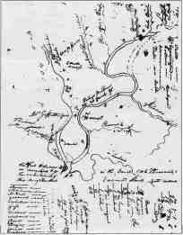
Clark and the crew reached the Camp Dubois location on December 12. He wrote, "...Nearly opposite the Missouries I came to in the mouth of a little River called Wood River...." The crew immediately went to work clearing timber and building living quarters. For years, historians, students of Lewis and Clark, and curious local residents have tried to pinpoint the camp location and determine the size and type of structures built. While maps and documents provide substantial evidence of the 1803-1804 site related to location of the Missouri and Mississippi rivers, identifying the exact point today is difficult because of periodic floods and changes in the channels of the Missouri, Mississippi, and Wood rivers. The Illinois Historic Preservation Agency, in cooperation with the National Park Service and local residents, located an interpretive center at Hartford, Illinois, to commemorate the campsite. The only detailed information about happenings at Camp Dubois appears in field notes scribbled by Clark on dozens of odd-shaped scraps of paper. In 1953, this remarkable written record, which also contains an account of the journey to the Mandan villages, was discovered in the attic of a house in St. Paul, Minnesota, and was published in 1964 (The Field Notes of Captain William Clark, 1803-1805). Clark's notes included sketches of the keelboat and proposed layouts for buildings at Camp Dubois. The notes reveal that Clark maintained a busy schedule at Camp Dubois, meeting with scores of curious local residents, traders, and Indians. He even found time to explore the Indian mounds between Camp Dubois and Cahokia. Clark mentioned periodic disciplinary problems among the recruits, which occasionally rose to the level of serious incidents. During the absence from camp of Lewis and Clark in February, for example, a minor revolt against the ranking enlisted man in charge drew an angry response from Lewis and resulted in a trial. Visitors noted by Clark included Jarrot, on a trade mission to the upper Mississippi, and various members of the William Whiteside clan, who were among the first settlers in what is now Madison County. Residents within a day's travel brought goods to trade, and associates of William Morrison living nearby loaned Clark tools and contributed grain. A widow, probably the closest neighbor, did washing and sewing for the soldiers. As a penalty for drunkenness, soldiers were ordered by Clark to build a hut for the woman. Along with responsibilities for monitoring 32 behavior of men for the crew, Lewis and Clark devoted substantial time gathering information from experienced traders. Hay became a primary source because of earlier work as an employee of the North West Company, one of the early fur-trading outfits in central Canada, and personal trips he made to trade with Indians not far from the Mandan villages. Similar information about the middle Missouri River region came from John Hays of Cahokia—often mistaken for John Hay—who also had experiences near the Mandans. He often visited Camp Dubois with Hay. Historians attribute much of the expedition's success to good relations with Indian tribes and credit sources of information in the Illinois country. Hay, whose primary job was as a local government official in Cahokia, also had links to recent explorers of the Missouri River who provided maps and journals for study by the captains. The documents of greatest value were the property of James Mackay and his associate John Evans, who had traveled the Missouri from 1795 to 1797 as far as the Mandan villages. Mackay lived near St. Charles and met with the captains to provide additional detail. The Mackay/Evans materials, written in French, were translated and interpreted by Hays. The value of these maps and journals cannot be exaggerated. They provided accurate information on Indian tribes and the dangers of traveling on the Missouri and speculated on the journey further ahead to the Rocky mountains.
Late in March Clark picked up the pace of activity at Camp Dubois. Packing and storing goods on the boats received primary attention, while guns were mounted for protection in the wilderness. Hay stayed several days in April to help pack items Lewis and Clark used to cultivate friendship and trade with Indian tribes. There were days of levity, too, to ease the tension and strain. One day in May, Illinois visitors engaged some of the soldiers in a shooting accuracy contest. Of the defeated visitors, Clark wrote, "In Camp Shooting with the party all git beet and lose their money." The most important decision at Camp Dubois was selection of the permanent party for the Corps of Discovery. Lewis and Clark announced on April 1 that twenty-five men would be divided into three squads headed by sergeants for the journey to the Pacific Ocean. They also designated those who would make the trip only as far as the Mandans and return after the winter of 1804-1805. The joy of being in the Corps was expressed by Sergeant Ordway who wrote his parents that he was "so happy to be one of them." More than thirty men made the complete journey that ended two years and four months later. Finally, May 14 arrived, the day for departure. The boats were loaded and as many as forty men found their places, local residents ("Many of the Neighbouring inhabitents") gathered for the farewell. The boats were pushed away from Camp Dubois for the crossing of the Mississippi, and the upstream voyage on the Missouri began. Clark wrote matter-of-factly, "I set out at 4oClock to the head of the first of island in the Missourie...." Lewis forever established the significance of Camp Dubois in the expedition history by stating, "The mouth of the River Dubois is to be considered as the point of departure." Winding up business in St. Louis six days later, he joined the flotilla at St. Charles. The great adventure was under way. On September 23,1806, after two years and four months in the wilderness, the Corps arrived in St. Louis, triumphant and proud. Only then could everyone realize how important information gathered in the Illinois country had been to success of the expedition. 33 |
|
|
 Source: Robert E. Hartley,