 |
Home | Search | Browse | About IPO | Staff | Links |
|
Home | Search | Browse | About IPO | Staff | Links |
|
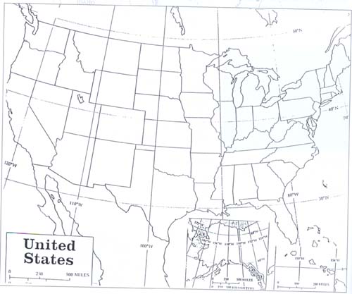
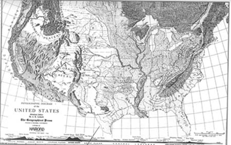
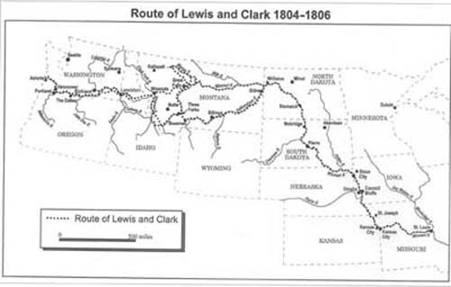
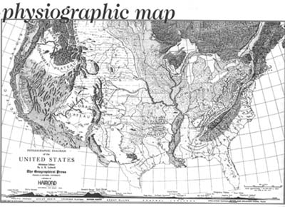
CURRICULUM MATERIALS Fred H. Walk Overview Main Ideas What is the geographic significance of the route that Lewis and Clark carved out on their monumental trip from the confluence of the Missouri and Mississippi rivers to the Pacific Ocean? Students will assess the impact of the Lewis and Clark passage by focusing on the corridor concept. Maps will be studied to determine the route of Lewis and Clark and determine the location of major cities, railroads, and interstate highways relative to the route. Connections with the Curriculum This activity can be used when teaching about Lewis and Clark in United States history and in geography classes. These materials can be utilized with geography students as a mapping activity and when focusing on migration and settlement patterns. This activity may be appropriate for the Illinois Learning Standards 16.A.4a, 16.A.5a, 17.A.4b, 17.A.5. Teaching Level Grades 10-12 Materials for Each Student • Handouts 1, 2, and 3. • Additional maps if necessary; see <davidrumsey.com> Lewis and Clark Objectives for Each Student • Trace the route taken by Lewis and Clark on a political and physiographic map of the United States. • Compare the Lewis and Clark passage to contemporary maps showing the location of major cities, railroads, and interstate highways relative to the route. • Understand the concept of a corridor. • Assess the impact of the Lewis and Clark route by analyzing the corridor concept. SUGGESTIONS FOR TEACHING THE LESSON Opening the Lesson • Test students' understanding of the Lewis and Clark passage by providing them an outline map (Handout #1) of the United States. Instruct students to speculate on the trail route by drawing a line on the map. Please note that this might be difficult for many students—the idea is to set them up for the activity. Ask students what might help them determine the actual route taken by Lewis and Clark. • Provide students a physiographic map (Handout #2) and instruct them to utilize the features shown on the physiographic map to test the accuracy of their hypothetical route taken by Lewis and Clark. The idea is for students to try and determine the route of Lewis and Clark by observing and analyzing the features shown on the map. Point out the location of the confluence of the Missouri and Mississippi rivers (near St.Louis, Missouri) and Astoria, Oregon (near the mouth of the Columbia River) to help them determine the route. Instruct students to speculate once more on the passage of Lewis and Clark by tracing the route beginning at the Missouri-Mississippi river confluence to the Pacific Ocean near Astoria, Oregon. • Students can further test the route they traced by consulting maps and atlases showing additional physiographic features and details. • Provide students with a map (Handout #3) showing the actual route taken by Lewis and Clark. Instruct students to observe and analyze the physical features to determine the route taken by Lewis and Clark. • Engage students in a discussion about their speculations and the actual route taken by Lewis and Clark. 44 Developing the Lesson • Write the word corridor on the board and ask students to develop a definition. Direct the class towards reaching a consensus on the corridor concept by sharing their definitions and probing their assertions. Consult the narrative portion of the article to assist students in their development of the corridor concept. • Focus students' attention to the map (Handout #4) and instruct them to locate major cities that have developed along the route taken by Lewis and Clark. Instruct students to compare the passage of Lewis and Clark to the towns and cities shown on Handout #4.
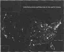
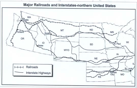
• Have students speculate on the location of railroads and interstate highways relative to the Lewis and Clark Trail. Discuss students' speculations. • Distribute Handout #5 showing the location of railroads and interstate highways. Instruct students to compare the passage of Lewis and Clark to the features shown on Handout #5 by drawing the passage on this map (page 50). Does there seem to be a correlation between the route and the features? Refer to the reading "A Geographer Looks At Lewis and Clark's Route and Its Later Impacts" for insights regarding the minimal correlation between the Lewis and Clark route and the features on Handouts #4 and #5.
• Distribute the reading "A Geographer Looks At Lewis and Clark's Route and Its Later Impacts." Provide students with the reading reaction sheet, Handout #6. Instruct students to develop responses to the questions and statements by focusing on the reading. Concluding the Lesson Engage students in a discussion of the geographical impact of the Lewis and Clark route and its impact as a transportation corridor by focusing on the questions contained on the reading reaction sheet.
Extending the Lesson • Engage students in a discussion of the Lewis and Clark journey by focusing on the impact of the route on the United States from a geographical, economical, political, and historical perspective. Upon which of these perspectives did the journey have the most impact? Instruct students to prioritize the impact by rank ordering the perspectives. • Have students identify major transportation corridors in the United States and determine the factors that led to the development of these corridors. Assessing the Lesson • Provide students with a physiographic map of the United States and instruct them to trace Lewis and Clark's trail. Instruct students to take a position and develop a response to the following statement: Lewis and Clark's trail had minimal impact upon the present-day geography of the Northwest United States. 45
46
47
48
49
50
Please respond to the following statements and questions to demonstrate your understanding of the reading. Use examples from the reading to clarify and support your responses. 1. Describe at least three factors that influenced the route taken by Lewis and Clark. 2. State the significance of the following statement: Historically, corridors began to develop when an easiest, or "lowest gradient," route from the coast to the interior was located and exploited. 3. Corridors tend to persist over time and remain locationally stable even after technology has changed. Provide evidence to support this statement. 4. Why are later routes resulting in corridors to the west very different than the route taken by Lewis and Clark? 5. Students of the landscape must be constantly alert never to look at a successful town and then to seek geographical reasons for that success. Show the significance of this statement by focusing on the location of Portland, Oregon. 51
Potential Answers for Questions/Statements from the Reading Log Question #1 1. Their journey had to be west-northwest rather than due west because the Pacific coast of California was not American territory. 2. The ignorance of Lewis and Clark regarding the location of mountain passes influenced them to follow the Missouri River. 3. Lewis and Clark's ignorance of distance influenced them to pursue seasonal routes through the mountains. Question #2 Physical features such as rivers, valleys, and mountain passes provided the path of least resistance that invited the development of corridors. Question #3 Once cities and places along the corridor are established, they wield considerable political power, economic clout, and social prestige to maintain the prominence of the corridor. This makes it difficult to establish corridors in other regions while the original corridor enhances its natural route. The Canadian province of Ontario is a good example. Question #4 Subsequent routes utilized by railroads and interstate highways located passes and valleys that offered lower gradients that made it more cost efficient for construction. Lewis and Clark were confronted with obstacles such as hostile Indians that made it difficult to discover the lowest gradient route. Question #5 It can be argued that railroad-related real estate speculators primarily influenced the location of Portland, Oregon and its regional influence. Portland developed as a major city following the extension of the railroad west along the Columbia River towards the Pacific Ocean. Essentially human activities (location of cities) are influenced not strictly by the physical geography but are also determined by people. 52 Extending the Lesson 1. Engage students in a discussion of the Lewis and Clark journey by focusing on the impact of the route on the United States from geographical, economical, political, and historical perspectives. Which of these perspectives did the journey most influence? Instruct students to prioritize the impact by rank ordering the perspectives. 2. Have students identify major transportation corridors in the United States and determine the factors that led to the development of these corridors. Assessing the Lesson Provide students with a physiographic map of the United States and instruct them to trace Lewis and Clark's trail. Instruct students to take a position and develop a response to the following statement: The route taken by Lewis and Clark had minimal impact upon the present-day geography of the Northwest United States. Alternative Assessment: Instruct students to state the significance of a corridor and determine the factors that influence the development and lasting power of a corridor. CURRICULUM MATERIALS
Lewis and Clark— Overview Main Ideas Students are presented with quotes and passages relating to the Lewis and Clark journey. Analysis of these statements will enable students to acquire a better understanding of this monumental passage up the Missouri River and to the Pacific Ocean. Connections with the Curriculum This activity can be used when teaching about Lewis and Clark in United States history and in geography classes. These materials can be utilized with geography students as a mapping activity and when focusing on migration and settlement patterns. This activity may be appropriate for the Illinois Learning Standards 16.A.4a, 16.A.5a, 17.A.4b, 17.A.5.
Teaching Level Grades 10-12 Materials for Each Student • Handouts 6 and 7 Learning Objectives • Understand the underlying reasons for the Lewis and Clark journey • Develop a chronological sequence of the Corps of Discovery • Analyze quotes/statements to better understand the groups of people encountered during the journey • Analyze quotes/statements to better understand the physical terrain Lewis and Clark encountered • Analyze and develop quotes/statements to formulate generalizations and inferences pertaining to the Corps of Discovery. 53 SUGGESTIONS FOR TEACHING THE LESSON Opening the Lesson Begin the lesson by distributing Handout #7. The idea is to test their basic understanding about Lewis and Clark's journey and acclimate the class for the rest of the lesson. Thomas Jefferson referred to the journey as the Corps of Discovery. Ask students to answer the questions in Handout #8. Developing the Lesson Distribute the quote/statement sheets (Handout #8) and instruct students to answer the questions that follow. Note that the spelling is directly from the journals that were written by Lewis and Clark. This can be a homework assignment, or students can work in groups to develop responses. Maps and atlases can be used to determine the locational references made in the quotes/statements. Concluding the Lesson Lead a class discussion that results in students formulating generalizations about the Lewis and Clark expedition. Have students formulate conclusions about the impact of the Corps of Discovery upon the United States. Extending the Lesson Instruct students to identify five additional events that capture the essence of the Lewis and Clark journey. These events can be shared with classmates and be used as the basis for a class discussion. Formulate their own quotes about various aspects of the Corps of Discovery journey. These quotes can be shared with their classmates or can be used as a basis for discussion. Assessing the Lesson Provide students with a physiographic map of the United States and plot the locations and identify the time references contained in the quotes/statements. Students can create a time line of the Lewis and Clark journey by identifying major events that occur during the expedition. Instruct students to formulate their own statements about various aspects of the expedition and reveal the significance of their statements.
54
1. When did Lewis and Clark begin and end their journey towards the Pacific Ocean from nearby St. Louis? Begin: _____________ End: _____________ 2. Provide a basic description of their route. 3. What was their primary means of travel? 4. How many people comprised the Corps of Discovery? 5. What was the purpose of the journey? 6. How many total miles did they travel? 7. Who was Sacagawea? 8. Who was York? 9. Who were the Mandans?
10. What was Fort Clatsop?
55
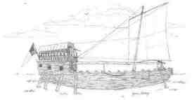
1. The journey began May 14, 1804, at four o'clock in the afternoon "under a jentle brease" and made four miles up the Mississippi. The journey ended on September 23,1806. 2. They left Camp Dubois on the Illinois side of the Mississippi River at the confluence of the Missouri and Mississippi rivers. They proceeded up the Missouri River, through the Rocky Mountain system, down the Clearwater, Snake and Columbia rivers to the Pacific Ocean. 3. Various types of water craft. A large keelboat and two canoes called pirogues. They used horses in the Bitterroot Mountains and also walked along the way.
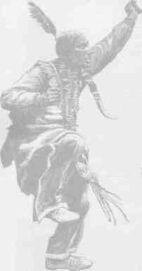
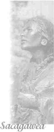
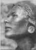
4. Nearly four dozen men accompanied Lewis and Clark. 5. Explore the Missouri River and determine the most direct water route across the continent. 6. Approximately 8,000. 7. She was an Hidatsa Native American woman who served as an interpreter and assisted the Corps of Discovery on their journey toward the pacific. She was about fifteen years old and six months pregnant when she joined Lewis and Clark in November 1804. 8. He was Clark's slave. 9. A Native American tribe living along the upper Missouri River in central North Dakota who materially helped the expedition survive the winter of 1804-05 on the Great Plains. 10. This was the name of the fort where the Corps of Discovery spent the winter of 1805-1806. It was several miles from the Pacific coast near a small river south of what is now Astoria, Oregon. The fort was named after the Clatsop nation of Indians who lived in the area. 56
Quotation/Statement #1 To Captain Meriwether Lewis. The object of your mission is to explore the Missouri river, & such principal stream of it, as, by it's course and communication with the waters of the Pacific ocean.....may offer the most direct & practicable water communication across this continent for the purpose of commerce. Thomas Jefferson A. Why was Jefferson interested in locating a water route across the continent?
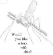
Quotation/Statement #2 Fourteen miles was considered a good day's progress. After two long months, they were still in what is now Missouri. The men suffered from snake bites, dislocated shoulders, sore joints, and occasional sunstroke. Others broke out in boils from a bad diet and too much time living in damp clothing. Their drinking water came from the river; each cup, one man recorded, was half mud and ooze. Virtually all of them got dysentery. Mosquitoes—some as big as houseflies, according to Clark—swarmed around their faces; they were "so numerous," Lewis said, "that we frequently get them in our throats as we breathe." A. What might this statement reveal about the conditions of the journey? 57
Quotation/Statement #3 Orderly Book, Camp New Island, July 12th, 1804. A Court martial consisting of the two commanding officers will convene this day at 1 OCk. P.M. for the trial of...such prisoners as are Guilty of Capatol Crimes, and under the rules and articles of War punishable by Death. Alexander Willard...charged with lying down and sleeping at this post whilst a sentinel....To this charge the prisoner pleads: Guilty of lying Down; and not guilty, of going to Sleep. .....The court...are of the opinion that the Prisoner..is guilty (and) do Sentence him to receive One hundred lashes on his bear back, at four different times in equal proportion---and order that the punishment Commence this evening at sunset.
William Clark A. What might this statement reveal about the relationship of Lewis and Clark and the men who were part of the Corps of Discovery? Quotation/Statement #4 When you white people met our Mandan people we gave to the whites the name Maci, meaning nice people, or pretty people. We called them by this name because they had white faces and fine clothes. We said also, "We will call these people our friends." Wounded Face
A. How might this statement reflect the the Corps of Discovery relationship with the Mandan people?
B. Would you have befriended Lewis and Clark if your were a member of the Mandan people?
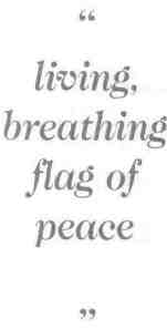
Quotation/Statement #5 No other member of the Corps of Discovery has inspired more mythology than Sacagawea, the young Indian woman who joined the expedition at the Mandan villages. She was a living, breathing flag of peace. A. What does it mean that Sacagawea was a living, breathing flag of peace? Quotation/Statement #6 The following quote refers to the eighteen-and-a-half-mile portage around the Great Falls of the Missouri River in Montana over rocky, broken ground under a broiling summer sun. The buffaloe have troden up the prairie very much (it) having now become dry, the sharp points of earth are as hard as frozen ground (and prickly pears) stand up in such abundance that here is no avoiding them. This is particularly severe on the feet of the men, who have not only therm own weight to bear in treading on those hacklelike points, but also have the addition of the burthen which they draw.... Meriwether Lewis A. What does the above indicate about the physical environment encountered by the Corps of Discovery? 59
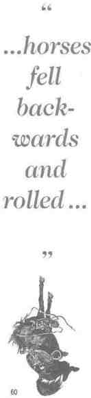
Quotation/Statement #7 Lewis was approaching the farthest boundary of the Louisiana Territory, the Continental Divide— the spine of the Rocky Mountains beyond where the rivers flow west. No American citizen had ever been there before. This, he believed, was the Northwest Passage: the goal of explorers for more than three centuries, the great prize that Thomas Jefferson had sent him to find and claim for the United States. Lewis was expecting to see the watershed of the Columbia River and beyond it, perhaps, a great plain that led down to the Pacific. Instead, there were just more mountains—"immence ranges of high mountains still to the West of us," he wrote, "with the tops partially covered with snow." A. Describe the feelings that Lewis might have had at this point in the journey. Quotation/Statement #8 William Clark made the following statement on September 18,1805, while crossing the Bitterroot Mountains. Some places (are) so steep and rocky that some of our horses fell backwards and rolled 20 or 30 feet among the rocks, but did not kill them.....We came to the highest part of the mountain, we halted....The mountains continue on as far as our eyes could extend. They extend much further than expected.
A. What are the implications of Clark's statement?
60
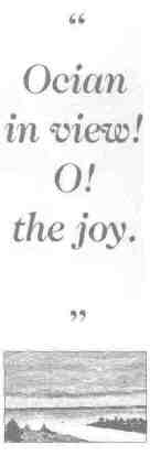
Quotation/Statement #9 On November 7, 1805, near the mouth of the Columbia River, after nineteen months of travel, Clark wrote: "Ocian in view! O! the joy." A. Why does Clark make this statement? B. What else might he have said to capture the moment? Quotation/Statement #10 When they launched their wooden boats up the Missouri and into the wilderness, Lewis and Clark were charting the future of America. A. How might Lewis and Clark and the Corps of Discovery be charting the future of America? Quotations are from Dayton Duncan and Ken Burns,
Lewis & Clark the Journal of the Corps of Discovery—An Illustrated History
1. p. 14
61 |
|
|